
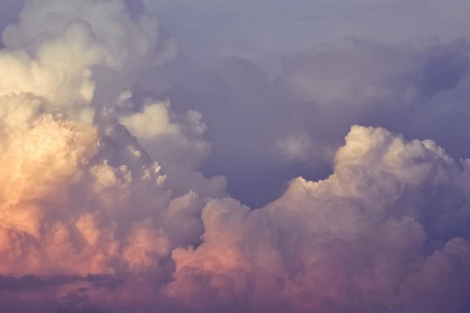
Long before forecasts arrived on our phones, people read the weather in the sky above their fields, and most of what they knew still works. Clouds are not decoration. They are the visible part of what the air is doing: rising, sinking, cooling, carrying water from one place to another. Learning to name a dozen of them, and to notice how they change through a day, turns every walk, every wait at a bus stop and every afternoon in a garden into a small act of forecasting. It is also simply lovely. This is a guide for beginners, from the door.
Three heights, ten families
The naming system most of us still use dates from 1803, when a London pharmacist and amateur meteorologist proposed Latin names for cloud shapes: cumulus for heaps, stratus for layers, cirrus for wisps, and nimbus for rain-bearers. Combined, these give the ten cloud genera, and it helps to sort them by height.
High clouds, above roughly 6,000 metres in temperate latitudes, are made of ice crystals: cirrus, cirrostratus and cirrocumulus. Middle clouds, between about 2,000 and 6,000 metres, carry the prefix alto: altocumulus and altostratus. Low clouds sit below 2,000 metres: stratus, stratocumulus and nimbostratus. And two are so tall they span all the levels: cumulus, the fair-weather heap, and cumulonimbus, the thunderhead, which can tower more than ten kilometres from base to anvil.
We do not need to memorise all of this at once. We need to look up, decide whether the cloud is high and wispy, middling and lumpy, or low and grey, and go from there.
Fair weather, and how to enjoy it
The cloud everyone draws as a child is cumulus, and the small, flat-bottomed, cauliflower-topped version is the friendliest cloud in the sky. It forms when the morning sun warms the ground, the ground warms the air, and the air rises in bubbles until it cools enough for its moisture to condense. The flat base marks the height where that happens, often between 500 and 1,500 metres, and it is why every cumulus over a landscape seems to sit on the same invisible shelf.
Fair-weather cumulus appear mid-morning, grow through the afternoon and melt away toward evening as the ground cools. As long as they stay wider than they are tall, the day is settled. Lying on our backs in a field watching them form and dissolve is one of the oldest outdoor pastimes there is, and it needs no equipment beyond a coat to lie on.
Signs of change
Most weather in temperate regions arrives from the west in the form of fronts, and a warm front announces itself a day or more ahead. The sequence is worth learning, because it plays out over our heads in the same order every time.
First come cirrus, the high wisps, sometimes hooked like commas, which old sailors called mares’ tails. Then the wisps thicken into cirrostratus, a thin white veil that dims the sun without hiding it and often draws a pale ring, a halo, around the sun or moon. The halo forms at an angle of 22 degrees, about a hand-span at arm’s length, and it is one of the most reliable signs in the sky: rain within a day or so, more often than not.
After the veil, the cloud lowers and thickens into altostratus, through which the sun shows as a smeared disc, as if seen through frosted glass. Then the base sinks further, turns dark grey and shapeless, and nimbostratus begins to rain, steadily, for hours. A mackerel sky of rippled cirrocumulus or altocumulus, seen the day before, tells the same story. The rhyme about mackerel skies and mares’ tails making tall ships carry low sails is old, and it is not wrong.
Showers and storms
Where fronts bring long, even rain, rising air brings showers, and the warning is in the shape of the cumulus. When a heap cloud grows taller than it is wide, with hard, bright, cauliflower edges, it has become cumulus congestus, and a shower is possible within the hour. When the top loses its crisp edges and turns fibrous or spreads out flat into an anvil, it has become cumulonimbus. Thunder, hail and sudden downpours live under those anvils, and the safe response, on a hill or a beach or an open field, is to head for shelter before the first rumble rather than after it.
A rough way to gauge distance is to count the seconds between the flash and the thunder and divide by three for kilometres. Under ten seconds, the storm is close enough to matter.
Reading the small things
Once the big families are familiar, the sky fills with details. These are a few worth noticing:
- Aircraft trails that vanish within a minute mean dry air aloft and settled weather; trails that linger and spread mean the upper air is moist and a change may be coming.
- Smooth, lens-shaped clouds sitting motionless over hills mark strong winds high up, even when the valley is calm.
- A red sky at sunset, seen in the west, means clear air is coming from that direction; a red dawn in the east means the clear air has already passed.
- Low cloud that fills a valley at dawn and burns off by ten is fog formed on a still, clear night, and it usually promises a fine day.
- A cumulus with a ragged, dark base and streaks of grey beneath it is already raining, and the shower is on its way to us if the wind is blowing from it.
Keeping a sky diary
The quickest way to learn clouds is to write them down. A notebook by the kettle, a line each morning and evening: what is up there, which way it is moving, what happened afterwards. Within a month the patterns begin to show, and within a season we will find ourselves glancing up on the way to the shops and quietly deciding whether to take a coat.
Cloud spotting suits every body and every budget. It can be done from a bed by a window, from a wheelchair in a park, from a pram-side bench with a small child pointing at the sky. The clouds are always there, always changing, and always free. All we have to do is look up and give them a name.